Background maps and orthophotos
In the Digital twin you can put a background map or your own orthophoto under your models, to see the site in its real surroundings.
Add a map or an orthophoto
- Open the Digital twin and, in the General tab, open Layers.
- Click Add new element.
- Choose Background map or Own orthophoto.
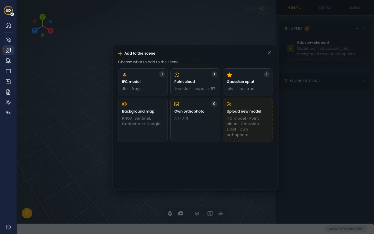
Background map
It is an image of the ground that VisionHub places at the project location. You can choose between:
- PNOA: orthophoto from Spain’s National Geographic Institute (Spain only).
- Sentinel-2: Copernicus satellite imagery, valid anywhere.
- Spanish Cadastre: Spanish cadastral mapping.
- Mapbox Satellite, with or without labels.
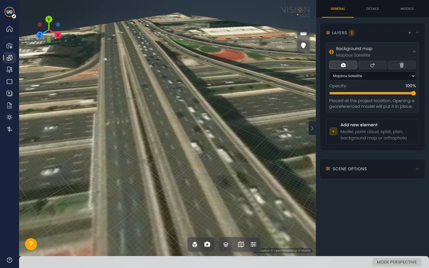
When you add one, VisionHub suggests PNOA if your project is in Spain and Sentinel-2 if it is elsewhere. From the layer card you can switch map, adjust the opacity and go to the map with the camera. If you open a georeferenced model, the map moves to its right place.
Own orthophoto
If you have an orthophoto of your site (for example from DJI Terra or Metashape), you can add it as a layer:
- It must be a GeoTIFF (
.tif) file. To view it smoothly, it should be optimized (COG); only the area you are looking at is downloaded. - You can upload it to the project or give its web address.
- If it is not a COG, convert it with QGIS or GDAL before uploading.
Thermal orthophoto
If your orthophoto is thermal (a single-band GeoTIFF holding the temperature of each pixel, like those exported by DJI Terra or Metashape), VisionHub does not treat it as a photo: it colours it by temperature and shows a legend in °C over the viewer.
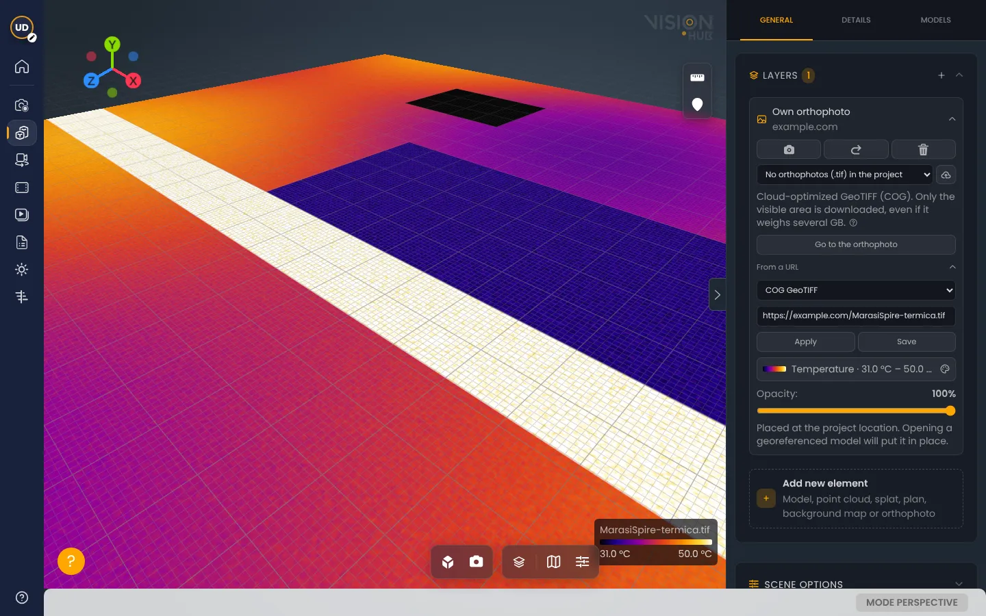
- For VisionHub to recognise that it measures temperature, the file name must say so, for example
MySite-thermal.tif. - In the layer card you can change the colour palette and the range of temperatures that is coloured.
- The same applies to other measurement maps, such as a digital elevation model.
Several layers at once
Each map or orthophoto is one layer in Layers. You can drag them to change the order: the one higher in the list is drawn on top. Layers last as long as the Digital twin stays open.
See also Digital twin and Point clouds.